Small town

Image

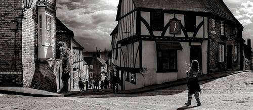
Carrying through my theme of miniatures and perspectives, I created a map of a town using the patterns of a stone floor. It already had the characteristics of a place with its shapes and levels, all it needed was someone to see it. I started off by choosing a piece of the floor that I thought had the most potential; this involved traits such as daylight, shadows, litter and shapes and depth of stones!

This was the area I chose for the birds eye view map:

Displaying IMG_0616.JPG
I figured that there was no need to be 100% realistic in what I was doing and this allowed the simplist of things to become important. This notion has become very relevant and useful in site specific performance as it has taught me to look beneath the view.
Stones became buildings, cigarette butts became crash sites from where they had fallen from the sky, scratches on the stone became the aftermath of a tiger escaping from the local zoo, the daylight and shadows became the separation between AM and PM in the town and so forth.
After blowing the picture up and printing it off I was able to draw my imagination…
https://www.flickr.com/photos/130878920@N06/16647407236/
I also made a key to accompany my map, so it makes sense to everyone else too!
https://www.flickr.com/photos/130878920@N06/16050990094/


‘I know it like the back of my hand’

In today’s lesson we were asked to follow some sort of map, or route. I started thinking of a more interesting way to find a route instead of drawing one on paper, of following a certain item. I do not know Lincoln very well and I especially do not know the top of the hill at all, this made me start to think about people who did know the area and got me asking questions like, how do we know where to go? Which direction do we take first? This linked me onto the phrase that people often use in a place they know very well – “I know it like the back of my hand.” This triggered me into thinking about that phrase literally rather than figuratively, because of course no one really looks at the back of their hand if they’re lost right? Well this got me thinking again, about what if I did use my hand to create the map; thus knowing the route ‘like the back of my hand’. https://www.flickr.com/photos/130645709@N04/sets/72157650897301775/

The next step was a starting point for the map on my hand, as I am quite vascular, I started with the most prominent vein and went from there, drawing on my hand, where I went and what I saw. However, following my veins ended rather quickly as a lot of the roads I travelled down were dead ends, resulting in me having to back track and to find a different route which weren’t ones that matched with my veins. This idea had a very interesting outcome as I feel like I was the only one who really understood my drawings and which direction was what, but overall found it to be very productive and I was able to find a route that I was happy with.